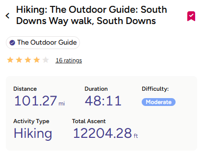
South Downs Way Facts and Figures
- Distance: 101.6 miles (163 km)
- Start Point: Winchester, Hampshire
- End Point: Eastbourne, East Sussex
- Highest Point: Butser Hill (270m / 886ft)
- Total Ascent: 12204.28ft
- Estimated Duration: 50 hours
- Duration: 8 days
- Average Daily Mileage: 12.7 miles
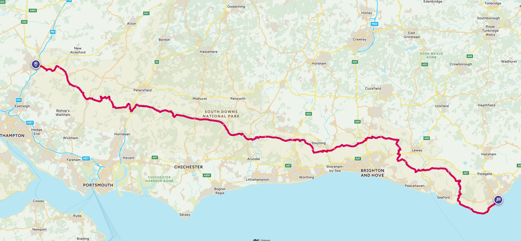
The full South Downs Way route is shown below and is available here on OS Maps
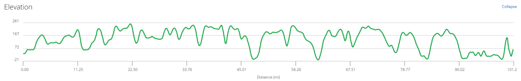
The Elevation Profile of the route shows there are plenty of ‘Ups’ as well as ‘Downs’ on the South Downs!
The table below shows the proposed start and end points for each of the 8 days, plus the cumulative mileage. Each of the Stages has a link to the details for that particular days stage.
| Day | Stage | Daily miles | Total miles | Day of week | Date |
|---|---|---|---|---|---|
| 0 | Travel to Winchester | Friday | 27 June 2025 | ||
| 1 | Winchester to Exton | 12.8 | 12.6 | Saturday | 28 June 2025 |
| 2 | Exton to Buriton | 12.8 | 25.7 | Sunday | 29 June 2025 |
| 3 | Buriton to Cocking | 11.5 | 37.2 | Monday | 30 June 2025 |
| 4 | Cocking to Amberley | 11.5 | 48.7 | Tuesday | 1 July 2025 |
| 5 | Amberley to Truleigh Hill | 14.8 | 63.5 | Wednesday | 2 July 2025 |
| 6 | Truleigh Hill to Housedean Farm | 13.1 | 76.6 | Thursday | 3 July 2025 |
| 7 | Housedean Farm to Alfriston | 14.2 | 90.8 | Friday | 4 July 2025 |
| 8 | Alfriston to Meads | 10.8 | 101.6 | Saturday | 5 July 2025 |
| 9 | Travel Home | Sunday | 6 July 2025 | ||
| Total -> | 101.6 |
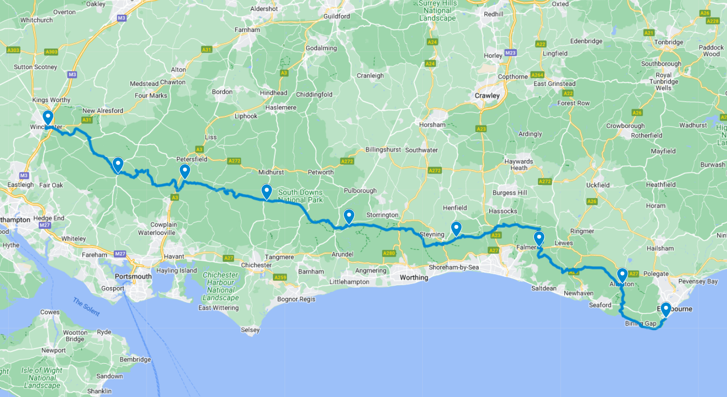
The map below shows the full 100 mile route from Winchester to Eastbourne with the stops for each day highlighted.
For anyone who wants to download the route, there is a link below to the GPX file which can be imported into most sports tracking apps.
The interactive Google Map below shows not only all of the daily stops, but the location of the water taps, our accommodation and most importantly the cafe’s and Pubs!
